SECTION 9. CONTENTS
Asia
South China Sea - Gulf of Thailand
Vietnam - Kampuchea
MUI ONG THAY TO MUI KE GA
From French, Japanese, and British Admiralty charts to 1958
with additions from surveys by the USS REHOBETH in 1965
USS SUNNADIN in 1965-66, and USS MAURY in 1967
Topograph and shoreline from other sources to 1967
Prepared and published by the
DEFENSE MAPPING AGENCY HUDROGRAPHIC/TOPOGRAPHIC CENTER
Washington, D. C. 20315-0030
SOUNDINGS IN FATHOMS - Scale 1:500,000
CHART NO. 93020
1st Ed., Apr. 1968
9° 42' 00" N 104° 22' 00" E
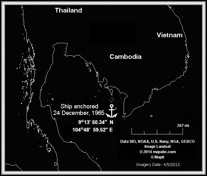
From logs of U.S. Naval ships and Stations, 1965, USS Savage DER-386.
[Christmas Outing 24 December, 1965 Friday].
0812 Underway as before.
0812 commenced maneuvering on various courses at various speeds to recover air drop.
0848 completed recovery. Set course 355 T, speed 12 kts. 0918 c/c 000 T. 0935 set the anchor detail.
0943 commenced maneuvering on various courses at various speeds. To hilo marine anchorage.
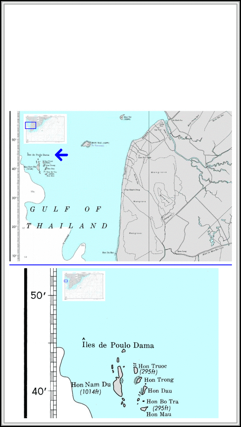
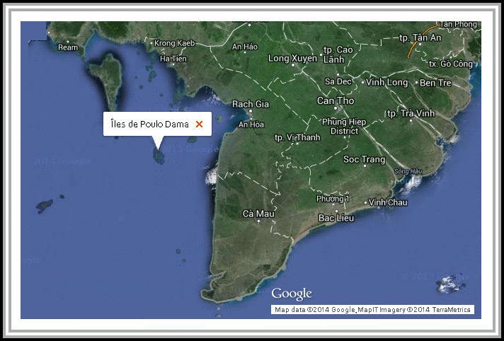
1001 all engines stop. Anchored off the Isle de Poulo Dama, South Vietnam in 8 fathoms of water. Mud bottom with 35 fathoms to the starboard anchor on the following bearings: Hon Mau 187 T Hon Dau 252 T Hon Trong 321 T.
1013 lowered the MWF.
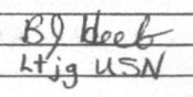
B. J. Heeb, LTJG, USN.
SEE PHOTOGRAPHS: Iles de Poulo Dama Party
o
o
SECTION 9.
Iles de Poulo Dama
^
| ||||
| ||||
| ||||
| ||||
| ||||
|

SOURCE: National Geospatial-Intelligence Agency
Top Right Coordinates of Chart 93020
Longitude 110 00' 00" E
Latitude 10 45' 00" N
o
o
Bottom Left Coordinates of Chart 93020 Longitude 104 15' 00" E
Latitude 7 05' 00" N
o
o
NOTE: The information regarding Iles de Poulo Dama in Vietnam on this page is published from the data supplied by the National Geospatial-Intelligence Agency, a member of the Intelligence community of the United States of America, and a Department of Defense (DoD) Combat Support Agency. No claims are made regarding the accuracy of Îles de Poulo Dama information contained here. All suggestions for corrections of any errors about Iles de Poulo Dama should be addressed to the National Geospatial-Intelligence Agency
Full Name: Îles de Poulo Dama
Latitude in decimal degrees: 9.7
Longitude in decimal degrees: 104.366667
Latitude in degrees, minutes, and seconds: 9° 42' 00" N
Longitude in degrees, minutes, and second: 104° 22' 00" E
Military Grid Reference System coordinates: 48PVR3052572308
Joint Operations Graphic reference: NC48-10
Modify Date: 1998-10-16
o
o
o
9 13' 50.34" N
104 48' 59.52" E
o
o